In today’s world, where technology drives innovation, remote sensing data has emerged as a vital tool across industries. This advanced method of collecting information about Earth’s surface and atmosphere without direct physical contact has revolutionized how we study and manage our planet. Whether you’re in agriculture, urban planning, disaster management, or environmental science, remote sensing offers actionable insights that were once unimaginable.
But what exactly is remote sensing data, and why is it so significant? Let’s dive in.
What is Remote Sensing Data?
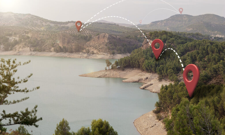
At its core, remote sensing involves gathering information about objects or areas from a distance, typically using satellites, drones, or aircraft. Sensors capture electromagnetic radiation reflected or emitted by the Earth’s surface, converting it into data. This data can be used to create images, maps, and other visual representations that help in analysis and decision-making.
There are two primary types of sensors involved in remote sensing:
- Passive Sensors: These rely on natural energy, such as sunlight, to detect radiation. Satellite imagery you see in weather forecasts often comes from passive sensors.
- Active Sensors: These emit their own energy, like radar or LiDAR, to measure how it interacts with surfaces. This is useful in cloudy or nighttime conditions where natural light isn’t available.
Applications of Remote Sensing Data
Remote sensing isn’t just about capturing pretty pictures from space—it’s a treasure trove of practical applications. Here are some ways industries leverage this data:
- Agriculture and Food Security
Remote sensing helps monitor crop health, soil moisture, and vegetation indices, enabling farmers to optimize irrigation, fertilization, and harvest schedules. This is crucial for addressing global food security challenges, especially in regions facing unpredictable weather patterns.
- Environmental Monitoring
Tracking deforestation, glacier melt, and ocean temperatures is possible thanks to remote sensing. It provides a bird’s-eye view of ecological changes over time, helping policymakers develop strategies to combat climate change.
- Urban Planning and Infrastructure
Planners use remote sensing data to analyze land use, assess urban sprawl, and identify suitable areas for new developments. High-resolution imagery ensures efficient planning while minimizing environmental impact.
- Disaster Management
In times of natural disasters like hurricanes, floods, or wildfires, remote sensing data proves invaluable. Real-time satellite imagery aids in disaster prediction, damage assessment, and rescue operations.
- Mining and Resource Exploration
Using remote sensing, geologists can identify mineral deposits and map terrain, significantly reducing the costs and risks associated with traditional exploration methods.
Benefits of Remote Sensing Data
Why has remote sensing gained so much traction? Here are some of its key advantages:
- Wide Coverage: Satellites can capture data from remote and inaccessible areas, making it possible to study regions that are otherwise difficult to reach.
- High Precision: Advanced sensors provide detailed, accurate measurements of environmental variables.
- Real-Time Monitoring: With modern satellite systems, data can be collected and analyzed in near real-time, enabling quicker responses to emerging situations.
- Cost-Effectiveness: Compared to traditional methods of field surveying, remote sensing is often more economical, especially for large-scale studies.
Challenges and Limitations
Despite its many advantages, remote sensing isn’t without challenges:
- High Initial Costs: Setting up satellite systems and acquiring high-resolution data can be expensive.
- Data Interpretation: Analyzing and extracting meaningful insights from remote sensing data requires expertise and robust analytical tools.
- Weather Dependence: Passive sensors, in particular, can be affected by cloud cover or poor lighting conditions.
- Data Overload: The sheer volume of data collected can be overwhelming, requiring efficient storage and processing systems.
The Future of Remote Sensing
As technology advances, so does the potential of remote sensing. Innovations like artificial intelligence (AI) and machine learning are enhancing data analysis, making it faster and more precise. Hyperspectral imaging, which captures hundreds of wavelengths per pixel, is unlocking new possibilities in fields like agriculture, geology, and environmental science.
Moreover, the rise of smaller, more affordable satellites—commonly known as CubeSats—has democratized access to remote sensing data. Governments, private companies, and even academic institutions can now deploy their own systems, further expanding the scope of applications.
Conclusion
Remote sensing data has become an indispensable tool for understanding and managing our planet. From addressing environmental challenges to improving urban planning, its applications are vast and varied. While challenges remain, ongoing advancements in technology promise to make this field even more impactful in the years to come.
As industries continue to embrace the power of remote sensing, the possibilities for innovation and sustainability are boundless. How might your organization leverage this technology to achieve its goals? The answers might be closer than you think—perhaps even from space!